08 June 2023
![[Blog] SWIFTT celebrates Copernicus 25th Anniversary](https://swiftt.eu/uploads/SWIFTT_web_copernicus.png)
![[Blog] SWIFTT celebrates Copernicus 25th Anniversary](https://swiftt.eu/uploads/SWIFTT_web_copernicus.png)
Today, June 8th, 2023, Copernicus celebrates its 25th anniversary.
Copernicus is the European Union’s Earth observation programme, which monitors our planet and its environment. The programme is served by a set of dedicated satellites (the Sentinel family) and contributing missions (other existing commercial and public satellites), along with ground-based, airborne and seaborne measurement sensors.
Copernicus provides vast amounts of data which are freely accessible to anyone, including service providers, public authorities and international organisations to improve the quality of life for citizens of Europe and around the world.
This information supports several applications in several non-space domains. In agriculture, the programme provides information for precision farming, with the assessment of land use and trends, crop conditions and yield forecasts. In the energy sector, Copernicus data enables the efficient exploitation of renewable energies with solar and wind energy production forecasting, renewable energy site selection, biomass monitoring, and water level monitoring.
In the forestry industry, observation data is used to provide forest mapping and forest change mapping, supporting the completion of national forest inventories.
As such, between 2017 and 2035, Copernicus is expected to generate between ten and twenty times the cost of the programme in benefits to European society.
Sentinel-1
The Sentinel-1 mission is Copernicus' radar observatory, which provides all-weather, day and night images.
Radars are extremely powerful tools for space imagery. They work by emitting a radio wave towards a target and collecting back its echo, the wave reflected on the target’s surface. In satellites, multiple radio signals are sent during the flight, along the satellite's ground track, and various echoes are received from the area of interest. By knowing the exact wave pattern sent out and the position of the sensor, it is possible to generate an image out of the raw data by measuring the time it takes for the radio waves to go from the satellite to the surface and back again.
This technique is called synthetic aperture radar (SAR), and it has the advantage of operating at wavelengths not impeded by cloud cover or a lack of illumination and can acquire data over a site during day or night time under all weather conditions.
Sentinel-1 can play an important role in sustainable forest management with clear-cut and partial-cut detection, forest type classification, biomass estimation and disturbance detection. For climate change, mapping forest fire scars can be an important part of investigating the carbon history of a forest and plays a critical role in estimating carbon emissions. Land cover maps can also be used to support forest management and the monitoring of illegal timber harvesting worldwide.
Sentinel-2
Copernicus’ Sentinel-2 mission carries an innovative wide-observation-area high-resolution multispectral imager with 13 spectral bands, from the visible and the near-infrared to the shortwave infrared.
Bands in the visible light spectrum correspond to the pigment in the leaves, while bands in the near-infrared correspond to the physical cell structure of the plant; and bands in the shortwave infrared region correspond to the water content in a plant.
As such, the mission offers a new perspective on our land and vegetation, by providing information that can be used to distinguish between different crop types as well as data on numerous plant indices, such as leaf area index, leaf chlorophyll content and leaf water content – all of which are essential to accurately monitor plant growth. This is particularly important for effective yield prediction and applications related to Earth's vegetation.
Tracking changes to forests is another task for the satellite, including checking rates of deforestation, reforestation and areas affected by wildfires. This information can help governments and companies to make informed decisions about how best to manage, protect and sustain our important forest resources.
SWIFTT
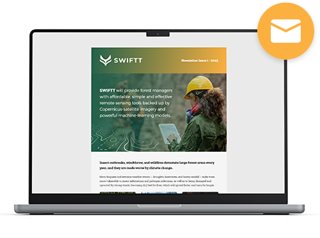
SWIFTT will use Sentinel-1 SAR data to provide forester with maps of windthrow damage after a storm for post-storm forest management, limiting the risk of future insect outbreaks and forest fires. Also, SWIFTT will use the rich Sentinel-2 data, to help foresters identify changes in tree health, map dieback in their forests, and to coordinate sanitary cuts faster, thereby preventing the spread of disease and insect outbreaks.
Hence, using Copernicus data and powerful machine-learning models, SWIFTT will increase forest management productivity and cost-effectiveness, and enable public and private forest managers, authorities, and policymakers to deal with forest threats proactively.
-
Next Article
SWIFTT partners Timbtrack and Groupe Coopération Forestière join EUROFOREST 2023 -
Previous Article
SWIFTT Newsletter #1 | 2023 - View All Articles

