![]() 26 October 2023
26 October 2023
Wildfires destroy hundreds of thousands of hectares of wildland and forest areas every year. Climate change is set to make it all worse by increasing the duration and frequency of heat waves and droughts, which provide more dry fuel for wildfires which spread faster and burn for longer.
Despite the extensive damage, their timely detection and cause assessment remains a challenge. Existing methods utilise satellite data to map burned areas and meteorological data to model fire risk, but there is yet no information technology to determine the causes, be it human-made or natural.
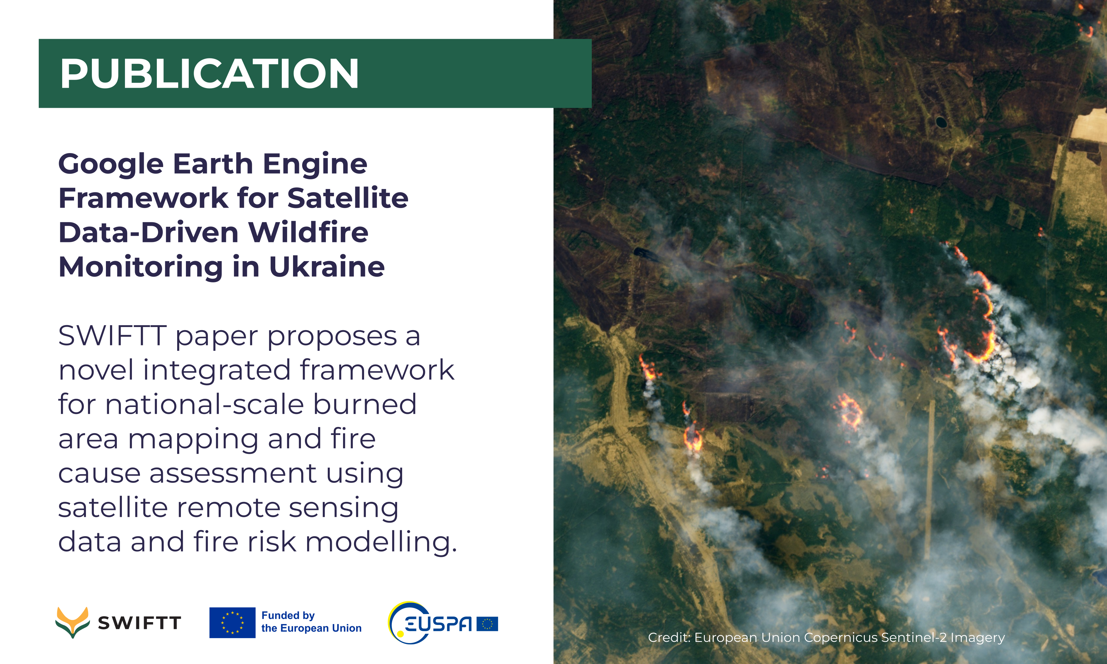
The war in Ukraine, which began on 24 February 2022, made higher spatial resolution information especially important to better understand the impact of military actions on the occurrence of fires. In this work, SWIFTT partners from the Space Research Institute of Ukraine and collaborators propose a novel integrated framework for national-scale burned area mapping and fire cause assessment using satellite remote sensing data and fire risk modelling. The methodology combines multi-spectral burned area mapping using the Normalised Burn Ratio index from Sentinel-2 imagery with fire danger analysis based on the Fire Potential Index calculated from vegetation, fuel moisture, and land cover data.
The approach was implemented for all of Ukraine in the Google Earth Engine cloud computing platform to enable efficient large-scale processing. Burned areas totaling 104,229 hectares were mapped during 15–17 July 2022, with cereal crops being the most affected land cover type. Comparison with the FPI fire risk map showed fires corresponded well spatially with high-risk areas in 2021 but not in 2022, indicating the 2022 fires were predominantly anthropogenic rather than climate-driven.
The study demonstrates the potential of applying integrated multi-source satellite data analytics in Google Earth Engine to develop scalable and automated systems for assessing wildfire activity and risks globally.
Source: Yailymov B, Shelestov A, Yailymova H, Shumilo L. "Google Earth Engine Framework for Satellite Data-Driven Wildfire Monitoring in Ukraine". Fire. 2023; 6(11):411. DOI: 10.3390/fire6110411

