Find below SWIFTT’s news articles, press releases, digests of scientific papers, as well as other outreach materials.

Timbtrack provides training to Forestry France
![]() 24 February 2025
24 February 2025
Field training in data collection with the SWIFTT mobile app happened in Col de la Moreno, France.

Timbtrack provides field training with the SWIFTT mobile app to EcoTree
![]() 07 February 2025
07 February 2025
The company provided invaluable feedback on the SWIFTT mobile app.
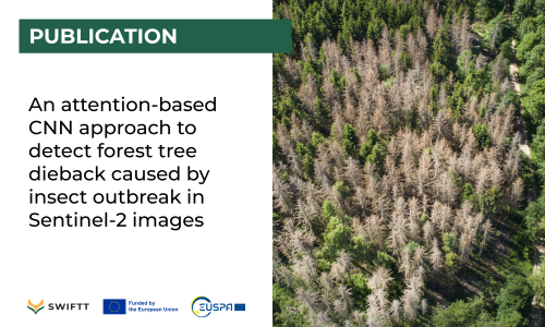
Publication: An attention-based CNN approach to detect forest tree dieback caused by insect outbreak in Sentinel-2 images
![]() 28 January 2025
28 January 2025
In this work, SWIFTT partners from the University of Bari Aldo Moro propose a deep learning-based approach, named AVALON, that implements a CNN to detect tree dieback events in Sentinel-2 images of forest areas.

Timbtrack provides field training in data collection with the SWIFTT mobile app to Rīgas Meži’s foresters
![]() 15 January 2025
15 January 2025
This data collection process is not only important for testing the platform and the associated apps, and to train machine-learning models

SWIFTT project highlighted in video by the EU Agency for the Space Programme
![]() 08 January 2025
08 January 2025
EUSPA supports the market development of the EU Space downstream sector and the uptake of space-based solutions through its Horizon Europe calls.

SWIFTT highlighted at the Da Vinci Dialogues
![]() 27 November 2024
27 November 2024
Event co-organised by project partner Da Vinci Labs and La Fabrique du Futur was held on November 26th, in Paris, France.

SWIFTT partner presents work at the 27th International Conference on Discovery Science
![]() 17 October 2024
17 October 2024
Research presented proposes a deep learning-based approach, named AVALON, that implements a CNN to detect tree dieback events in Sentinel-2 images of forest areas.
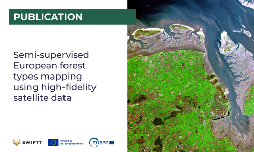
Publication: Semi-supervised European forest types mapping using high-fidelity satellite data
![]() 27 September 2024
27 September 2024
In this work, SWIFTT partners from the Space Research Institute of Ukraine introduce an innovative semi-supervised approach for mapping European forest types by harnessing the power of high-resolution Sentinel-1 and Sentinel-2 satellite data from the Copernicus program.

Researchers explore novel approach to map forest dieback in satellite images
![]() 25 September 2024
25 September 2024
Study published in the Journal of Intelligent Information Systems investigated the performance of a data-centric semantic segmentation approach to detect bark beetle infestation in satellite images. The results are part of the EU/EUSPA-funded project SWIFTT.

