Find below SWIFTT’s news articles, press releases, digests of scientific papers, as well as other outreach materials.
Separated by War: Deforestation and Reforestation in the Ukrainian Emerald Network
![]() 11 December 2023
11 December 2023
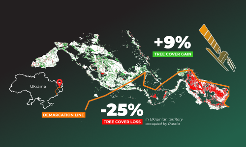
Press Release - Study published in Nature Communications Earth & Environment finds stark differences in forest dynamics between Ukraine- and Russia-controlled territories between 2014 and 2020. The methodology was developed as part of the EU/EUSPA-funded project SWIFTT.
SWIFTT consortium launches first project video
![]() 30 November 2023
30 November 2023
SWIFTT will provide forest managers with affordable, simple and effective remote sensing tools backed up by powerful machine learning models.
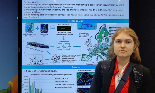
SWIFTT project presented at the GEO Week and the Ministerial Summit 2023 in Cape Town, SA
![]() 23 November 2023
23 November 2023
The SWIFTT project was presented at the stand of the European Commission, which invited projects funded by the Commission contributing to the achievement of the GEO strategic goal of this decade 'Data for All'.
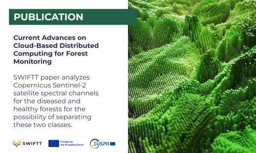
Publication: Current Advances on Cloud-Based Distributed Computing for Forest Monitoring
![]() 18 November 2023
18 November 2023
Publication: SWIFTT paper analyses Copernicus Sentinel-2 satellite spectral channels for the diseased and healthy forests for the possibility of separating these two classes.
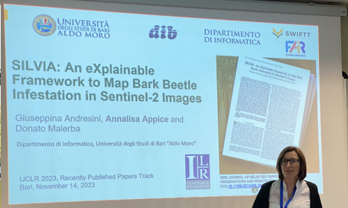
SWIFTT paper presented at the 3rd International Joint Conference on Learning & Reasoning (IJCLR)
![]() 16 November 2023
16 November 2023
The paper explores how machine learning methods can be used to map bark beetle infestation hotspots in Copernicus Sentinel 2 images by leveraging spectral vegetation indices and performing self-training.
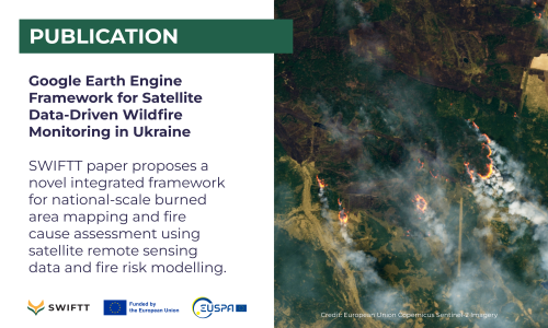
Publication: Google Earth Engine Framework for Satellite Data-Driven Wildfire Monitoring in Ukraine
![]() 26 October 2023
26 October 2023
SWIFTT paper proposes a novel integrated framework for national-scale burned area mapping and fire cause assessment using satellite remote sensing data and fire risk modelling.
SWIFTT partner presents the project’s solutions at the EuroGEO workshop.
![]() 05 October 2023
05 October 2023
EuroGEO brings together and coordinates activities in Europe that contribute to the initiatives of the Group on Earth Observations (GEO).
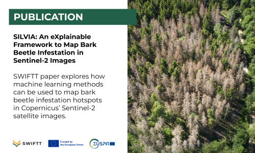
Publication: SILVIA - An eXplainable Framework to Map Bark Beetle Infestation in Sentinel-2 Images
![]() 18 September 2023
18 September 2023
In their recent paper, SWIFTT partners from University of Bari Aldo Moro, explore how machine learning methods can be used to map bark beetle infestation hotspots in Sentinel-2 images by leveraging spectral vegetation indices and performing self-training.
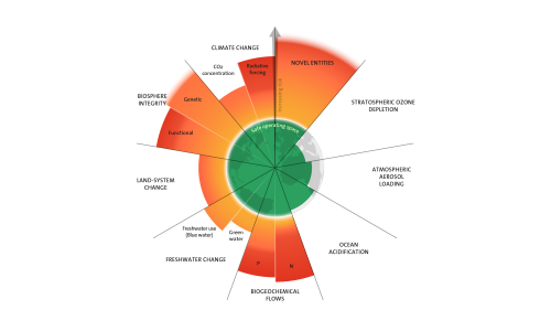
Stockholm Resilience Centre: All planetaryboundaries mapped out for the first time
![]() 15 September 2023
15 September 2023
From globalwarming to the biosphere and deforestation, from pollutants and plastic to nitrogen cycles and freshwater: Six of nine planetary boundaries are being crossed.

